December 2007 Newsletter
Grave Site Identification on St. John, Virgin Islands:
The Use of Grave Markers and Commemorative
Space during the Danish Colonial Period
By Helen Blouet
Figures 1-13
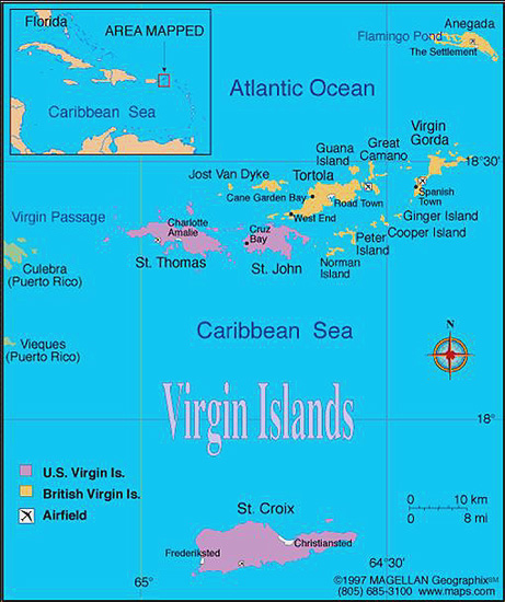
Figure 1: St. John Map.
[Return to Article]
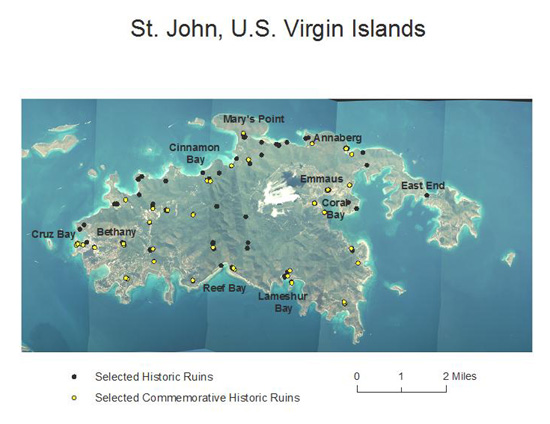
Figure 2: Location of historic cemeteries in relation to plantation and habitation ruins.
[Return to Article]
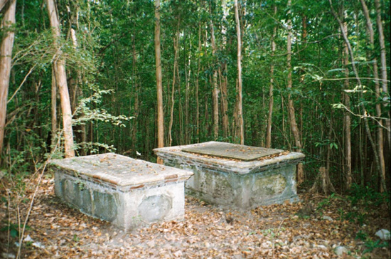
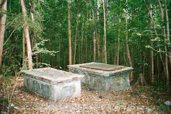
Figure 3: Cinnamon Bay, Hjardemaal cemetery, looking northeast.
[Return to Article]
Figure 4: Cinnamon Bay, Hjardemaal cemetery, looking southwest.
[Return to Article]
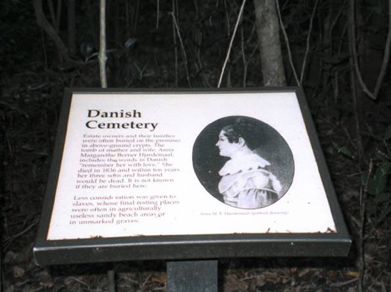
Figure 5a: Hjardemaal graves (above) and US National Park explanatory plaque (below), Cinnamon Bay.
Figure 5b: US National Park explanatory plaque for Hjardemaal graves, Cinnamon Bay.
[Return to Article]
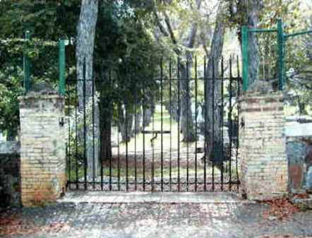
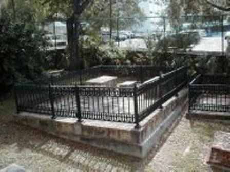
Figure 6a: Danish Cemetery, entry gate (above) and Hjardemaal family plot (below), Charlotte Amalie, St. Thomas.
Figure 6b: Danish Cemetery, Hjardemaal family plot, Charlotte Amalie, St. Thomas.
[Return to Article]
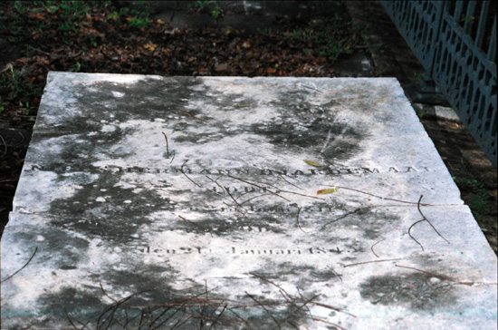
Figure 7: Niels Hermann Hjardemaal, d. 1845, Danish Cemetery, St. Thomas.
[Return to Article]
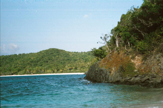
Figure 8: Shoreline and hillside, Leinster Bay, St. John.
[Return to Article]
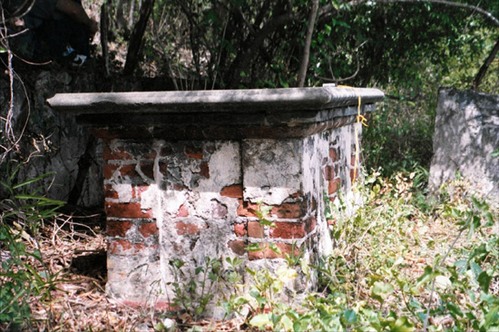
Figure 9: James Murphy's grave, early 19th century, Leinster Bay.
[Return to Article]
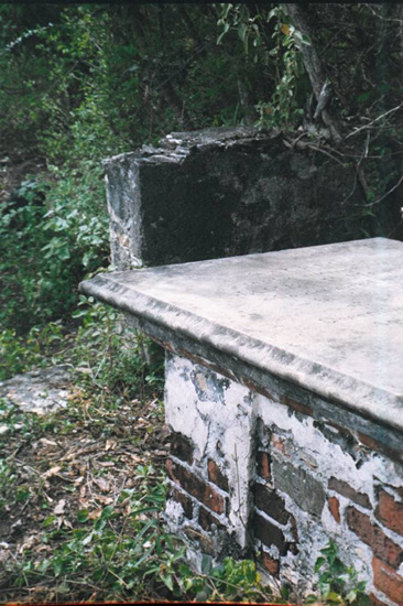
Figure 10a: James Murphy's grave (above) and enclosing wall (below).
[Return to Article]
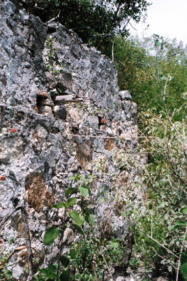
Figure 10b: Enclosing wall to James Murphy's grave.
[Return to Article]
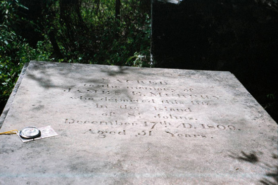
Figure 11: J. Murphy's inscription, with the mistaken year of death in 1809 (he actually died in 1808).
[Return to Article]
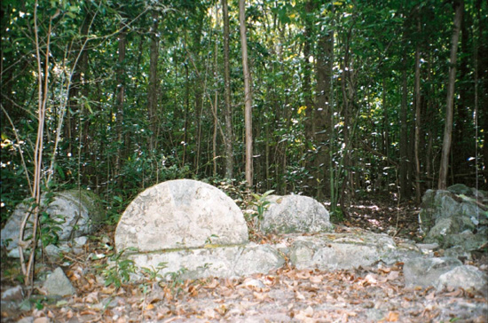
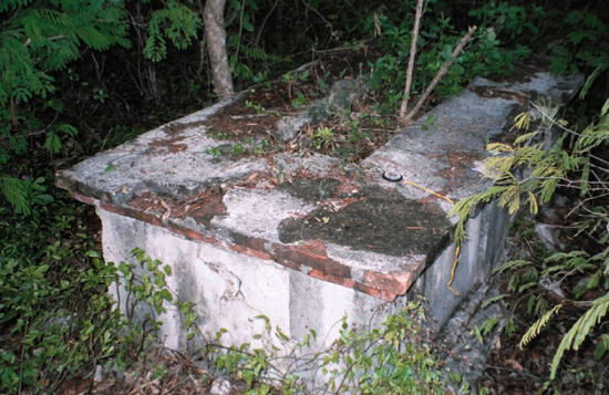
Figure 12: Uninscribed grave near J. Murphy's, Leinster Bay.
[Return to Article]
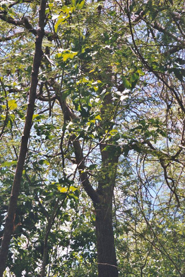
Figure 13: Tamarind trees near grave remains, Lameshur Bay, St. John.
Return to Article
View Figures 14-26
©2007 African Diaspora Archaeology Network
Copyright and all rights reserved by
individual authors for each article.
Please send comments, suggestions, or questions
to Chris Fennell at cfennell@uiuc.edu
Last updated: December 10, 2007
Text only menu
Search